 Written by : Bob Metcalfe
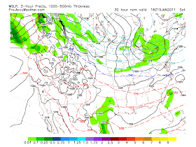
A small Alberta Clipper will graze the area tomorrow and bring a general 2-4" of new snow to the area. With cold temperatures abound and much of our previous snow still packed well on the ground, this will likely mean poor driving conditions during the late morning and afternoon. The higher amounts will most likely fall nearest to the shoreline as most of the energy with this storm resides north of the area. Breaking things down by late Saturday night, but cold air will pour in for Sunday which will drop us back into the SINGLE digits early Monday morning.
Sounds like enough to roll the plow for a few folks including myself! I know others have asked this too...where in the world has Charles been?? I hope that he is okay as we havent heard from him in awhile!
ReplyDeleteThink next week is going to be more rain than anything temps. going up on the models.
ReplyDeleteThis blog has basically shut down! Maybe it is the calm before the storm next week doubt it. 2 out of the 3 local guys think this will be nothing one says it could get real interesting mid week. I think I go with the majority.
ReplyDeleteIt will not be a big deal. SMal system with a mix to some rain.
ReplyDeleteThe blog is very very quite must mean the storm Tuesday will be nothing for us.
ReplyDeleteIt will be nothing for us. If we get light snow we would be lucky. The coastal low will be too far east as usual. It is what it is.
ReplyDeleteevery storm misses us its nothing new!
ReplyDeleteIs Wayne county really going to get a foot of lake effect by tomorrow?
ReplyDeleteQuiet very quiet where is DK, David and Henry? It must going to be a real dud storm here next Tuesday- Wednesday.
ReplyDeleteWell as some have said earlier there is nothing with this storm precipitation is getting pushed more and more east. It will be a minor event and a storm next weekend will be far east. The only thing to look forward to is it will get cold next weekend single digit lows that is about it. Thanks
ReplyDeleteNo comment until the snow is falling from sky.
ReplyDeleteDavid not sure what that means?
ReplyDeleteOur snow has winded down. We really didnt get much at all. Lots of blowing snow tho! Maybe a new one will arise in a few weeks!
ReplyDeleteHaha im tired and forecasted out....
ReplyDeleteSignificant lake effect snow MIGHT hit the Rochester metro beginning either tonight or tomorrow. Several inches likely from the city north. Greece and Webster could be the hardest hit. The NWS is dropping the ball on this one. They only have Wayne county under the Warning, but they will likely need to add Monroe county. This is just my Unprofessional opinion based on what I see with the wind vectors. Likely a 300 or 310 flow will drop the band over the city for at least several hours. Just giving a heads up. Expect a surprise snow event for Rochester soon.
ReplyDeleteDK when to you think that will start and besides the city what suburbs may be impacted? Bob just said not in the city.
ReplyDeleteHamlin, Hilton, Greece, Irondequoit and Webster have the best chance for it. I DO think it will reach the city of Rochester. Hard to say exactly when, but sometime between late tonight toward the wee hours of the morning, or perhaps sometimes during the day Sunday or Sunday evening. That timing part is tough, as it depends how quickly the winds veer to more WNW. But in any case, I think that the city of Rochester itself will have a several hour period of moderate snow which could pile up multiple inches in a hurry. Again, just a disclaimer - I'm not a professional meteorologist, and these are just my personal opinions based on looking at various models and radar imagery upstream.
ReplyDeleteDK, Looks like that might be starting to happen now.... Looks like some flare up over northern MOnroe
ReplyDeleteCold without snow is a waste. No storms in sight. They will go east of us. We should be used to that now.
ReplyDeleteDK was right! Enjoy it fellas!!! We have bright sunny skies down here in the southerntier but I see some clouds off the the west of us and the radar shows some activity off of Erie. Who know, we may seem some flakes off of that.
ReplyDelete