
More Nice Weather!
Written by John DiPasquale:
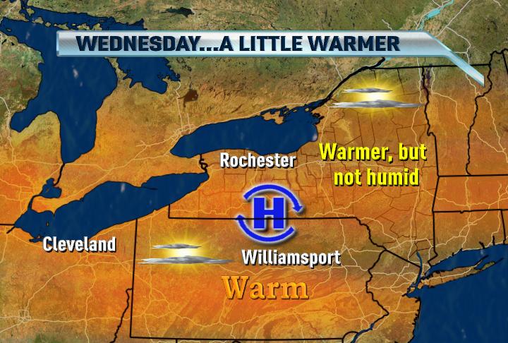
High & dry weather will basically continue through Friday with just an outside chance of a pop up storm or two later Friday, as the heat & humidity slowly increase, especially come Friday. High pressure will keep us warm & comfy through Thursday with highs in the low to mid 80s with a good deal of sun, but Thursday night into Friday high pressure will slowly drift to the east & result in more of a southerly flow of warmer, more humid air. This will set the stage for a better chance of seeing a few scattered storms later Saturday, & even a bit more so for Sunday afternoon & evening. Highs come Friday should range from 85 to 90, while mid 80s will probably be what we feel over the weekend due to more clouds & a few showers & storms being around. We need the rain, though, so yes we would prefer not getting it over the weekend, but I guess we'll take it when we can get it. At this point, it looks like there will be a good amount of dry time this weekend, but just a better shot at getting some scattered showers/storms. Stay tuned.
Have a nice day WNY!
Keep the rain away!!!!!!!!!!!
ReplyDelete