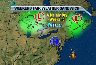
Love these Types of Sandwiches!
Written by John DiPasquale:
Today will be brisk & cool, but nice under tons of sun! High pressure providing us with nice day today will keep us high & dry for the most part through the weekend, as a storm over the Atlantic retrogrades toward the Northeast, & another one to the NW sends a cold front this way for later Easter Sunday. However, it appears even Easter Sunday is now looking mainly dry with some clouds drifting in later in the day & maybe a shower or two passing through to finish our holiday. All in all, though, the holiday weekend is looking good & you'll definitely want to enjoy it because it still looks like late Sunday into early next week the two storms in the above pic will merge over Southeastern Canada & provide an unseasonably chilly semi moist flow Monday through at least Wednesday! There will also likely be some graupel & snow showers flying at times, especially late Monday night through Wednesday! The trough should then break down some by next weekend. Stay tuned for more details in the days to come.
Have a great holiday bloggers!!

No comments:
Post a Comment