
Windy & Warm Monday
Written by: Stacey Pensgen
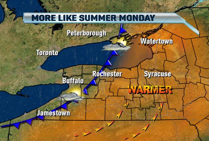
Solidly in the warm sector behind a warm front, Monday will feature near-record warmth. The record is 85 degrees set back in 2002, and the combination of a good deal of morning and early afternoon sun, plus a deep southwesterly flow will allow temperatures to soar between 80-85 by the afternoon. A strong cold front doesn't come through until later afternoon/evening, so we will have almost the whole day to heat the atmosphere.
When the front does come through, we'll likely find showers and storms developing, some of which may produce some gusty winds. Rochester and areas west are also under a Wind Advisory through the evening. Enjoy the warmth, and hopefully a good gullywasher or two! We could really use the rain right now.
Stacey,
ReplyDeleteWhat are the chances that the storms on Monday become strong to severe?
Thanks.
There is a decent chance for some damaging winds to blow through with the storms. The front comes through later in the day, so we'll have almost a full day of a good deal of sunshine, temps well in the 80s so we'll have a fair amount of instability. Definitely something to watch, but nothing like the tornado outbreak in the Midwest yesterday and today.
ReplyDelete- Stacey
Should I plug my aiconditioner?
ReplyDeleteWhat happend to the front? It was very weak and only produced some ligh sprinkles.
ReplyDeleteWe never got any strong lift with this front so storms never really developed. I would have liked to see that low closer to us for strong storms to develop. Also the air was very dry in the area as well. Dewpoint temperatures stayed in the 50s all afternoon.
ReplyDeleteScott