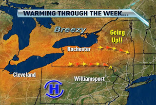
Warmth Builds through Friday
Written by John DiPasquale:
After a cool start to the week, we will warm it up significantly by week's end thanks to a warming west-northwest flow. Yes, a west-northwest flow will be warming us well into the 80s Thursday, & eventually to near 90 by Friday. Usually a west-northwest flow cools us, but this time very warm air will be coming up & over a ridge of high pressure moving in from the west over the next few days. So we started the week in the 60s for highs, today we will make it into the 70s, Wednesday will be around 80, & then as mentioned above we will be pretty hot by week's end. All the while high pressure nearby should keep us mainly dry during the warm up too, so if you have outdoor plans you are looking quite good!
The weekend should cool a bit behind a weak cold front swinging through Friday. On Sunday, though, it should heat up a bit more & turn more muggy ahead & with another weak front due to move in later Sunday. This feature may trigger a few showers & storms to end the weekend, but it is still 5 days out, so lots can happen/change between now & then. Stay tuned. Highs over the weekend should be in the low to mid 80s. Great news for your pool party or beach/boat plans!
Enjoy the cool winds today everyone!

No comments:
Post a Comment