
Some Lake Snows on the Way
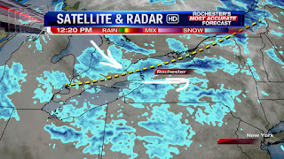

A trough in the top pic should slide through later this afternoon & early tonight bringing about a quick burst of snow for many, & likely making for a slick ride home for many too, including the Greater Rochester area. In the wake of the trough, winds will be more northwesterly & eventually become almost northerly late tonight into Thursday. This will keep the lake snows going, but they will slowly taper off later Thursday afternoon/early Thursday night thanks to drier air pushing in, & a lowering inversion due to high pressure building in. Accumulations for many near & north of 90 should range from about 2 to 6", with a bit more northwest & northeast of the Rochester area. Additional minor accumulations will occur Thursday, especially through early afternoon.
Friday looks nice n' quiet, but after a little warm up late Friday night into Saturday, it is looking more & more like we will be affected by the developing storm near the coast later Saturday through early Sunday. The big question is how much precip will fall & the type. At this juncture, & it could very well change, it appears that precip would begin probably as rain for most Saturday afternoon, before mixing with & probably changing to wet snow Saturday evening. Some accumulations are possible for all, especially over the high terrain Saturday night. Confidence is still not that high with this weekend's storm, but definitely something to really keep a close eye on, as most of the models are now trending more to the west & north the last day or so with the coastal low. Stay tuned...
Again not sure what John is talking about this weekend? That storm is way east and north of us. Not one station including his is talking about having to definitely "something to really keep a close eye on"? John has done this often. I appreciate he is the only met who posts on the blog lately but please be accurate.
ReplyDeleteSNOWING AND WINDY IN HAMLIN. NOT LOOKING MUCH LIKE SPRING. I agree with John on this weekends storm something to watch if we can get some colder air pulled down. Also storms to watch next week. WINTER IS NOT OVER YET. Come to Hamlin if you think spring is here that will change your mind.
DeleteHello Anonymous 3:40, I was looking at data, & the latest trends. Sorry, but not sure what exactly you are looking at? I don't really care what everyone else is doing. I see what I see, & go with my own thoughts. I'm not saying it's going to happen, but to ignore the possibility is something I will never do! All I have to say is...past experiences. While it now appears most, if not all, of this storm will miss us to the south & east, another shift to the west over the next 36 hours could still happen & change things once again Saturday night. I would rather inform the viewers that there's a possibility, instead of totally ignoring it, & then have to surprise everyone the day of, or day before. Thanks.
DeleteBest,
John
I love this. Someone with zero eduction in meteorology is telling the meteorologist that he would appreciate accuracy. I think John has more experience and knowledge than anyone else on this blog.
DeleteNot true. Look at the latest GFS.
ReplyDeleteNot a flake in Macedon.
ReplyDeleteexcept you
DeleteWe are in a no storm zone. Storms to our West, North, South and East. We are in a bubble. Storms are deflected away from Rochester unless it is a rain storm.
ReplyDeleteWe have about 3" of fluff and it is still snowing pretty good here in Wayland. We were only in the T-3" zone for last night.
ReplyDeleteHard to measure because of the wind, but in areas protected from the wind it looks like about 1-2" of fluffy lake effect in NE Fairport.
ReplyDeleteAndy
Does anyone know about any possible storms. Even Scott on his forecast last night seemed unusally interested about a few potential storms next week. He even said winter is far from over.
ReplyDeleteModels are showing a vort thats just sits over us for days on end with ample snow opportunities starting mid next week....
ReplyDeleteWith all due respect but what does that mean Weatherguy?
ReplyDeleteBoston getting hammered again this weekend oh the jealousy.
ReplyDeleteNWS forecast for March just out--- probability favors above ave temps. Let's hope they are right and it happens soon. This weather has been misery.
ReplyDeletePerhaps more accurate than computers there has been much more bird and animal activity in woods usually a sign they think it is getting ready to get warm. Also smelled some skunk activity--if they are coming out of hibernation then that is a good sign for a warm up.
My humble guess is it starts off cool but ends very warm. Second half of the month making it above average over all.
DeleteI agree. It'd be nice to have a repeat of last march but that ain't gonna happen this year.
DeleteLess than 1" in Gates. Guess our zip code wasn't a target.
ReplyDeleteWow, we are going to miss out on another East Coast Storm. Shocker!!!!! Boston could see over a ft again.
ReplyDeleteThere are storms all over the nation every winter and every geographic location misses out on the vast majority of them.
DeleteRochester misses out on about 99% of them.
ReplyDelete